
Geospatial Technologies in Transportation
Street Map Conflation
 |
 |
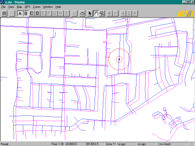
The blue map is more accurate than the pink
map.
Left: Before conflation, a vehicle's GPS location (red circle correctly registered on blue map) is apparently mid-block with respect to the streets in the pink map.
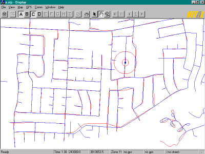
Right: After conflation, the pink map is congruent with the blue map, so the GPS location is correctly shown even in the pink map.
The technique relies on a set of tie points. As long as tie points are dense, conflation is satisfactory. When tie points are scarce (as on the east-west road in the south), there is residual error, but network topology is preserved.
Developed by DGRC in a project with NCGIA, University of California, Santa Barbara.
Left: Before conflation, a vehicle's GPS location (red circle correctly registered on blue map) is apparently mid-block with respect to the streets in the pink map.
Right: After conflation, the pink map is congruent with the blue map, so the GPS location is correctly shown even in the pink map.
The technique relies on a set of tie points. As long as tie points are dense, conflation is satisfactory. When tie points are scarce (as on the east-west road in the south), there is residual error, but network topology is preserved.
Developed by DGRC in a project with NCGIA, University of California, Santa Barbara.
|
|
|
| © Digital Geographic Research Corporation | Contact us |