Geospatial Technologies in Transportation
Street Map Error
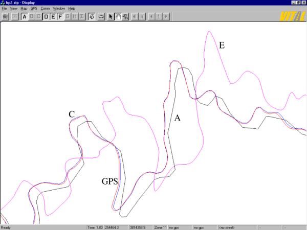
Three digital centreline maps (A, C and E) of the same road.
Differential GPS survey (red) verifies that database C is most accurate.
Database A has highly generalized linework, but is relatively true, within 50 metres.
Database E has spuriously smooth arcs, but positions are in error by up to 200 metres.
Illustration from DGRC project at NCGIA, University of California, Santa Barbara
Back: Geospatial Technologies in Transportation
©
Digital Geographic Research Corporation
Contact us